Short Title:
MACBLUE - Coastal Carbon Sinks Pacific
Description

Starting Situation

Seagrass, mangroves and salt marshes sequester carbon at rates up to 66 times faster than terrestrial forests and store up to 5 times more carbon per hectare. Pacific Island Countries (PICs) possess significant Seagrass and Mangrove (SaM) resources, providing further ecosystem services related to shoreline protection, food security, tourism revenue and water quality. Habitat loss has been increasing rapidly, yet no adequate baselines exist to determine extent of habitats, rates of loss, or design of targeted management solutions. Methods for the assessment of carbon stocks and emissions in SaM areas exist since 2012, but have not been applied consistently to SaM areas in PICs. Policy makers and researchers note the urgent need to collect nationally relevant SaM data based on consistent methods, that ensure transparency and traceability to mitigate the loss of the world’s coastal carbon sinks and reduce the decline of coastal biodiversity.


Short Project Description

In close collaboration with national and regional partners (SPREP, SPC, USP, CSIRO, CIFOR) and the “Blue Planet” Initiative within the global Group on Earth Observations (GEO), the project will be mapping the SaM status in each of the 4 partner countries, and will assess related carbon storage capacity and ecosystem services. Resulting national inventories of SaM habitats, and associated blue carbon sinks and ecosystem service values will support government partners and policy makers in their efforts to strategically develop and implement conservation, management and rehabilitation efforts. Governments will be assisted to establish nationally appropriate incentives for sustainable management and rehabilitation efforts based on the quantification and documentation of SaM carbon stocks and the resulting emission reductions as part of NDCs and National Adaptation Programmes of Action (NAPAs).

Replication Potential

In the context of collaboration with national and regional technical agencies the project will refine and adapt remote sensing data technology for SaM mapping and carbon storage assessment methods for wide-ranging application in PICs during and beyond the project period. Project-based demonstration of effective mapping, monitoring and management regimes aims to foster and support national and regional capacity and up-scaling of these approaches in partner countries and neighbouring PICs. Collaboration and sharing of techniques and experiences with the IKI project “Blue Solutions – Implementing the CBD Strategic Plan in the field of marine and coastal biodiversity” and with the currently planned regional project on “Conservation of biodiversity, seagrass ecosystems and their services – safeguarding food security and resilience in vulnerable coastal communities in a changing climate ” will maximise replicability within the wider region and in collaboration with further global stakeholders
Funding
Donor
Organisation: BMUB-the International Climate Initiative (IKI) of the German Federal Ministry for the Environment, Nature Conservation, Building and Nuclear Safety
Total Funding USD:
$10,066,198.00
Progress Indicator
50-75%
FRDP Goals
Goal 2: Low-carbon Development
Project Status
Current
Project Comments

BMUB-Funding: 9.220.000 Euro in USA is - USD 10.066056

Project Type
Planning and Governance
Policy Formulation and Integration
Policy Support
Implementing Entity/Organisation
Organisation: GIZ
Project Contact
Name: Jesse Benjamin
Additional details: Department: Department of Environmental Protection and Conservation Position: Director General-Ministry of Lands and Natural Resources
Project Map Points
Short Title:
GEF8_Restoring and Protecting Bio
Description

The project will improve climate change resilience, food security and livelihood opportunities through community led NBS in coastal communities in Vanuatu. The expected impact is improved and resilient biodiversity, coastal lands, nearshore aquatic resources and livelihoods for the local population.


Primarily, the project will benefit the governments of Vanuatu, and will directly improve the lives of 22,500 beneficiaries/5,000 households equally distributed across Vanuatu. Women and youth will be prioritized, but because the project aims to improve biodiversity, coastal lands, nearshores and aquatic resources, it will benefit the entire populations of Vanuatu.


The project starts with a participatory approach with stakeholder engagement activities for the identification of NBS and the identification and development of women and youth lead entrepreneurship. Through these approaches, participatory conservation and restoration efforts will be truly led by women and youth groups, in partnership with local authorities, through entrepreneurial activities linked to sustainable tourism and learning, as well as community-fisheries that will ensure the empowerment of women, girls and boys and ensure the long-term sustainability of the project. When planning support to strengthen community resilience, the point of departure is to recognize the ever evolving and dynamic nature of communities and the underlying vulnerabilities that challenge them. Being resilient includes being flexible in the face of changing risks, which are especially accentuated in the Pacific given their exposure to climate variability, and increasingly influencing risk patterns along the steps of a change management process for sustainable development. To enable communities to strengthen resilience through NBS, the below elements will be included in the first phase of the project: (i) a broad understanding of the climate induced risks from inaction and its consequences; (ii) a holistic approach to community resilience, as these are multidimensional systems within wider systems, meaning that coordination should be across sectors and should be operationalized across levels; (iii) responding to communities’ own understanding of the risks of inaction and the benefits of sustainable NBS which promote income generation; (iv) people centred, or listening and understanding people’s perspectives; (v) being inclusive, without discrimination.


The main objective of this project is to “improve climate change resilience, food security and livelihood opportunities through community led NBS in coastal communities in Vanuatu.”


There are 3 components:

  1. Develop and implement gender sensitive national policies to support nature-based solutions and ecosystem valuation
  2. Restore and protect coastal biodiversity, lands, nearshore and aquatic resources through community-led NBS and entrepreneurship, in locations with high dependence on biodiversity and ecosystem services (for resilience and livelihoods).
  3. Facilitate knowledge sharing, awareness and collaborative engagement for ecosystem management between communities, islands, countries and territories.


Phase I (January to December 2024): This phase will be marked by a strong focus on achieving Outcome 1 and the activities.


Outcome I: NBS for women and youth Identified


The following activities will be technically designed and led by FAO in close collaboration with UNOPS, local and

national authorities and other relevant partners.

  • Activity 1.1: Develop community profiles of the loss of biodiversity, coastal lands nearshore and aquatic resources through participatory consultations and mapping in 11 communities in Vanuatu.
  • Activity 1.2: Identify the scope of biodiversity, coastal lands, nearshore and aquatic resources restoration and protection by consulting 11 communities in Vanuatu.
  • Activity 1.3: Identify and prioritise traditional practices related to NBS by consulting 11 communities in Vanuatu.
  • Activity 1.4: Identify at least 5,000 households from Vanuatu on the basis of their ongoing relevant activities and endorsement by local and national authorities to implement NBS entrepreneurship activities.


Phase II (January to December 2025): This phase will be marked by a strong focus on achieving result 2 and the associated activities.

Outcome II: Women and youth led NBS entrepreneurship established for about 5,000 households.           

  • Activity 2.1: Select at least one demonstration site for using NBS and entrepreneurship to restore and protect biodiversity, coastal lands, nearshore and aquatic resources in consultation with local and national authorities in each of the targeted communities in Vanuatu.
  • Activity 2.2: Train about 5,000 households in NBS approaches to the restoration and protection of biodiversity, coastal lands, nearshore and aquatic resources in Vanuatu. Organise two separate workshops on restoration and protection.
  • Activity 2.3: Propagate, replant and regenerate about 200,000 coastal trees and shrubs in Vanuatu, including through direct seeding. This will include distribution of kits to about 5,000 households, each kit containing at least 15 tree seedlings/propagules (mainly food and culturally important trees), information and tools.
  • Activity 2.4: Train about 5,000 households in NBS entrepreneurship. This will cover small business skills, agritourism, value addition, post-harvest handling of crops and fish, marketing and digitalization.


Phase III (January to December xxxxx): This phase will be marked by a strong focus on achieving Outcome 3 and 4, and the associated activities.

Outcome III: A gender sensitive policy to adequately manage coastal ecosystems is developed and implemented 

  • Activity 3.1: Enhancing and strengthening of the gender sensitive National Policies for ecosystem management with practical and precise action plans, informed by the project experience of scalable solutions in Vanuatu.
  • Activity 3.2: Implement the gender sensitive National Policies developed with practical and precise action plans, informed by the project experience of scalable solutions in Vanuatu


Outcome IV: Public communication campaign promoting NBS developed and implemented via knowledge sharing. 

  • Activity 4.1: Drawing on the FAO SIDS Solutions Platform, which facilitates knowledge sharing, identify and develop electronic and video profiles of at least 6 scalable solutions from Vanuatu (5) for learning and learning between Project sites targeted by this project.
  • Activity 4.1: Organize and facilitate at least three virtual knowledge sharing and learning workshops that draw on, and promote scalable solutions from the project experience between the targeted Project sites
Funding
Donor
Organisation: GEF ( Global Environment Facility )
Total Funding USD:
$4,453,333.00
Progress Indicator
0-25%
Sendai Priorities
Priority 1: Understanding disaster risk
Priority 2: Strengthening disaster risk governance to manage disaster risk
Priority 3: Investing in disaster risk reduction for resilience
FRDP Goals
Goal 1: CCA/DRR
Project Status
Current
Project Comments

 Theme(s) :- Mitigation- Cross Cutting- Adaptation- DRR/DRMTotal funding (Vatu and USD ) LAND DEGRADATION: 170,002,710 VT (USD 1,450,000)BIODIVERSITY: 221,589,740 VT (USD 1,890,000)BGI IP: 130,491,740 VT (USD1,113,333) LocationErromango Kauri Protected Area (EKPA): 3,000haUnique population of native species Kauri, Agathis macrophylla (https://youtu.be/H1vvvdSvb5Y ), adjacent important Marine Conservation Area Manaro Lake Forest (Ngoru//Vui//Lakua): 450haSacred volcanic lake and national wetland site. Vanua Lava: 15,000haDeclared biodiversity hotspot with high number of endemic species of flora and fauna; AZE (Alliance for Zero Extinction) site and key site for sustainable tourism. Malo: 7,550haRich in marine biodiversity (existing and proposed MPA); Malo Pass protected forest/catchment. 

Project Scope
National
Project Type
Capacity Building
Community Awareness
Knowledge Communication
Policy Support
Executing Entity/Lead Government Agency
Organisation: Department of Environmental Protection and Conservation
Implementing Entity/Organisation
Organisation: FAO
Project Locations
Erromango Kauri Protected Area, Port Narvin - North Erromango, VU
Project Map Points
Description

The aim of the project is to apply Critical Participatory Action Research (CPAR) to empower targeted communities in Community Conservation Areas (CCA’s) to develop rights-based regenerative climate-smart ridge to reef landscape and food system design and management plans that support food and nutrition security and overall well-being.

Funding
Total Funding USD:
$1,650,000.00
Progress Indicator
25-50%
Project Status
Current
Project Scope
Community
Project Type
Capacity Building
Research
Implementing Entity/Organisation
Organisation: University Of Sunshine Coast
Project Contact
Name: Laurana Rakau- Tokatakee
Additional details: City: Port Vila
Project Map Points
Short Title:
BRANTV - Phase II
Description

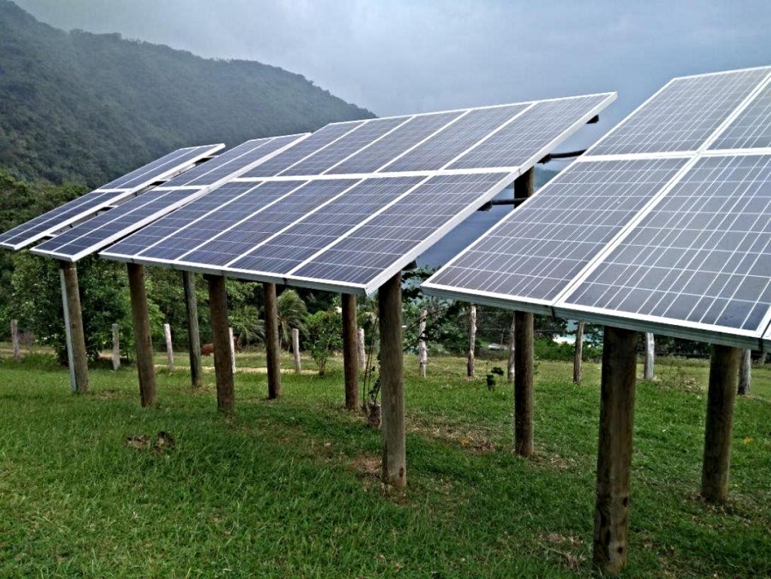
The project considers the current Vanuatu’s Off-Grid RE and EE Promotion Program as the main baseline effort towards achieving the country’s NERM targets. This program includes the installation of RE-based (mainly hydro, and solar) power generation and distribution systems, as well as some Energy Efficiency interventions. This project aims to fill in critical gaps in Vanuatu’s baseline program.


  1. Policy and planning: The project will identify important policy and planning gaps and institutionalize existing policies and plans in place (NERM-IP Plan and NERM) in the baseline program that it will fill, such as guidelines, standards, and incentive policies.
  2.  Institutional: The project will focus and represent relatively innovative incremental aspects. System management will be a critical feature in the sustainability of rural RE systems and their replication and thus an instrumental contribution towards meeting NERM targets.
  3.  Capacity development:  While Vanuatu has substantial baseline program efforts to install RE systems in off-grid areas, training is very limited and generally consists of one-time training upon installation of systems. For larger-scale systems, capturing wind energy, equipment sourcing, and installation capacity is absent.

Green transport: The project will aim to set example of green transport mechanism by introducing electric vehicles

Financing for energy efficiency: The focus will be given to educating the commercial private sector to set up a loan or equity financing mechanism for Energy Efficiency Equipment and productive uses in rural areas.

The project considers the current Vanuatu’s Off-Grid RE and EE Promotion Program as the main baseline effort towards achieving the country’s NERM targets. This program includes the installation of RE-based (mainly hydro, and solar) power generation and distribution systems, as well as some Energy Efficiency interventions. This project aims to fill in critical gaps in Vanuatu’s baseline program.


  1. Policy and planning: The project will identify important policy and planning gaps and institutionalize existing policies and plans in place (NERM-IP Plan and NERM) in the baseline program that it will fill, such as guidelines, standards, and incentive policies.
  2.  Institutional: The project will focus and represent relatively innovative incremental aspects. System management will be a critical feature in the sustainability of rural RE systems and their replication and thus an instrumental contribution towards meeting NERM targets.
  3.  Capacity development:  While Vanuatu has substantial baseline program efforts to install RE systems in off-grid areas, training is very limited and generally consists of one-time training upon installation of systems. For larger-scale systems, capturing wind energy, equipment sourcing, and installation capacity is absent.

Green transport: The project will aim to set example of green transport mechanism by introducing electric vehicles

Financing for energy efficiency: The focus will be given to educating the commercial private sector to set up a loan or equity financing mechanism for Energy Efficiency Equipment and productive uses in rural areas.


Location: 

The project is focused on outer Islands of the country and emphasis will be given to the areas not covered by BRANTV/GEF project and Green Energy Transformation Project (JSB). Specific site will be selected during development of full proposal.


Pico-hydro PV hybrid demo: 1

Large PV mini grids (about 100 kW each): 5

Institutional PV systems (1.9 – 5.2 kW each): 20

Household-scale PV demos (120 W to 1.6 Kw): 100

Family compound-scale PV deployed across full villages: 20

Wind energy system (wind turbine): 1

Funding
Donor
Organisation: Global Environment Facility (GEF) Star Allocation
Total Funding USD:
$2,000,000.00
Progress Indicator
0-25%
FRDP Goals
Goal 2: Low-carbon Development
Project Status
Proposed
Project Scope
National
Project Type
Capacity Building
Community Awareness
Knowledge Communication
Pilot / Trial / Demonstration Project
Planning and Governance
Policy Formulation and Integration
Policy Support
Research
Other
Implementing Entity/Organisation
Organisation: United Nations Development Programme
Project Contact
Name: Anthony Garae
Phone: 678 - 25201
Additional details: City: Port Vila Department: Department Of Energy Position: The Director, Department of Energy
Project Map Points
Short Title:
NORAD Project - UNOSAT
Description

In July 2021, UNOSAT and the Norwegian Agency for Development Cooperation (NORAD) signed a new cooperation framework to sustain and expand their longstanding efforts to strengthen capacities in the use of geospatial information technologies for improved resilience in the Asia-Pacific and Africa.
This 3 year-long project builds on previous experiences and aims to further enhance capacities by leveraging technological advances and innovation and providing integrated geospatial solutions for improved decision making in the fields of Disaster Risk Reduction, Climate Resilience, Environmental Preservation & Food Security in the eight target countries: Vanuatu, Fiji, Solomon Islands, Bangladesh, Bhutan, Lao PDR, Nigeria, and Uganda.
An innovative user-centred capacity development approach will be applied for the implementation of this project, and it is comprised of:
• Technical Training: Through the implementation of this project in each target country, UNOSAT will offer a total of three technical trainings custom-tailored to the country’s needs, with focus on climate finance, geospatial information technology, and disaster risk management. The courses will be delivered to both executive managers and technical staff, through three main approaches: face-to-face, blended learning, and e-learning solutions.
• Knowledge Platform & Community of Practice: The project team will also implement a central Knowledge Platform for the project, this will serve as an integrated learning environment for all distance-learning solutions and the main meeting point of UNOSAT’s community of practice, all aiming at sustaining the project outcomes and increasing its impact. The knowledge platform will also facilitate cross country knowledge and expertise sharing for tackling common challenges.
• Access to Climate Finance: There is a strong need for Pacific SIDS to finance their climate changes adaptations strategy; however, there is limited capacities in preparation of project proposals to climate funding. This project will integrate the Climate Finance Access Hub of the Commonwealth Secretariat (CCFAH) to use the established channels for increasing success in accessing climate funds. With the deployment of a climate finance advisor, the objective will be to facilitate improved access by partner countries to climate finance mechanisms to meet their priority needs in realizing sustainable development goals. As of April 2020, the Hub has helped countries to access USD 33,605,291 of climate finance, with USD 572,639,261 in the pipeline.
• Technical Backstopping and In-country Expert: Technical backstopping will be the backbone of the capacity development applicability and sustainability. From comprehensive risk analysis to modern web mapping systems and Operations Dashboards, various products will be developed to support informed decision making in partner countries. A minimum of eight backstopping services will be provided to each of the beneficiary countries, which can be considered as mini geospatial projects for improving or optimising existing operations. The in-country national expert will work on-site and hand-in-hand with the beneficiary ministry with technical support from the project team.
• Decision Support Applications: UNOSAT will develop in each country one smart web-based applications that can ingest data from available baseline datasets, satellite images, scientific models and generate meaningful insight to steer decision making. Complex data analytics will be carried out with automation scripts on UNOSAT cloud computing infrastructure, so analysts do not need to perform repeated analysis, saving valuable resources and time. The results will be accessible to a range of national stakeholders through dedicated decision support platforms.

Funding
Donor
Organisation: UNITAR - UNOSAT
Progress Indicator
25-50%
Project Status
Current
Project Scope
Regional
Project Type
Capacity Building
Community Awareness
Disaster Response
Knowledge Communication
Planning and Governance
Other
Executing Entity/Lead Government Agency
Organisation: Vanuatu: Ministry of Climate Change, Change Adaptation,Meteorogy,Geo-Hazards,Environment,Energy and Disaster Management
Implementing Entity/Organisation
Organisation: United Nations Satellite Centre
Project Contact
Name: Einar Bjorgo
Phone: 0041 076 691 01 06
Additional details: Address: 7 bis, Avenue de la Paix, CH-1202 City: Geneva 2, Department: United Nations Satellite Centre (UNOSAT), United Nations Institute for Training and Research (UNITAR) Position: The Director for the United Nations Satellite Centre
Project Locations
NORAD Project - Strengthening capacities in the use of geospatial information for improved resilience in Asia-Pacific and Africa, Port Vila, VU
NORAD Project - Strengthening capacities in the use of geospatial information for improved resilience in Asia-Pacific and Africa, Suva, FJ
NORAD Project - Strengthening capacities in the use of geospatial information for improved resilience in Asia-Pacific and Africa, Honiara, SB
NORAD Project - Strengthening capacities in the use of geospatial information for improved resilience in Asia-Pacific and Africa, BD
NORAD Project - Strengthening capacities in the use of geospatial information for improved resilience in Asia-Pacific and Africa, BT
NORAD Project - Strengthening capacities in the use of geospatial information for improved resilience in Asia-Pacific and Africa, LA
NORAD Project - Strengthening capacities in the use of geospatial information for improved resilience in Asia-Pacific and Africa, NG
NORAD Project - Strengthening capacities in the use of geospatial information for improved resilience in Asia-Pacific and Africa, UG
Project Map Points
Short Title:
WRD-Vanuatu
Description


The Women’s Resilience to Disasters (WRD) programme is fully funded by the Government of Australia and proposes a comprehensive package to strengthen the resilience of women and girls with the goal of ensuring that the lives and livelihoods of women and girls are resilient to disasters and threats, contributing to sustainable, secure, and thriving communities.


The WRD programme will initially be implemented in Kiribati, Vanuatu, and Fiji. Programme implementation will be driven at country level and supported by regional and global components.

The country components will provide targeted action to strengthen women’s resilience and build gender-responsive systems, advancing different elements of the WRD depending on the national context, policy priorities, existing initiatives, needs, and capacities.


At the regional level, the focus will be on knowledge management, advocacy, and gender and disability support for regional mechanisms, movements, and coalitions, including the Pacific Resilience Partnership.


The global component will advance gender-responsiveness in global DRR and climate processes, provide technical support, ensure global knowledge sharing and advocacy on women’s leadership for disaster resilience, and provide a platform for sharing good practice for gender-responsive resilience and voices from the Pacific.


The expected Outcomes for WRD are two-fold:
1) Prevention, preparedness, and recovery policy frameworks, systems, processes, and tools are gender-responsive, and implemented as a result of local women’s and girls’ advocacy; and
2) Women and girls have voice and agency to withstand multiple hazards, recover from disasters, and increase their resilience to future disasters and threats.


At the country level, the WRD Programme will work with government ministries, UN agencies and regional partners, and CSOs including women’s organisations.


The programme’s principles are localization and ownership. In line with these principles, women’s organizations and DRR and resilience stakeholders will be key partners in programme implementation and monitoring and evaluation. The programme will contribute to key international processes and frameworks, including Agenda 2030, the Sendai Framework, the WHS outcomes, and the Humanitarian- Development-Peace Nexus.

Funding
Donor
Organisation: Australian Government- Department of Foreign Affairs and Trade
Total Funding USD:
$1,150,000.00
Progress Indicator
25-50%
Project Status
Current
Project Scope
Regional
Project Type
Capacity Building
Community Awareness
Field Implementation
Funding - Small Grants
Informal Training Courses
Knowledge Communication
Pilot / Trial / Demonstration Project
Policy Formulation and Integration
Policy Support
Implementing Entity/Organisation
Organisation: Department of Women Affairs
Project Contact
Name: Betty Toa
Organisation: Department Of Women Affairs
Additional details: City: Port Vila Department: United Nation Women - Vanuatu Position: Country Programme Coordinator
Project Locations
Project - Women’s Resilience to Disaster’s Programme (WRD)-Vanuatu, Port Vila, VU
Project - Women’s Resilience to Disaster’s Programme (WRD)-Vanuatu, KI
Project - Women’s Resilience to Disaster’s Programme (WRD)-Vanuatu, Suva, FJ
Project Map Points
Description


Volcanic island countries in the Pacific are facing severe issues related to environmental degradation and climate variability. Deforestation and unsustainable land and water use, uncontrolled livestock grazing on fragile lands and poorly planned settlements in environmental and hazard-sensitive areas are drivers of environmental degradation. Drought is a major natural hazard all Pacific Island Countries (PICs) are facing, with agricultural drought presenting a particular problem for the leeward side of larger volcanic islands.


Alongside land resources, the economic and social well-being of PICs are dependent upon the quality and quantity of their freshwater resources. However, the ability of small island countries to effectively develop and manage their water sectors is often constrained by their small size and limited human resource base. In many island countries, factors such as increasing demand for water, rainfall variability, storm water runoff, inadequate sanitation, and waste disposal, threaten economic development and human health.


Fresh groundwater resources in volcanic islands of the Pacific are particularly abundant, as demonstrated by the plethora of freshwater springs, private and public groundwater bores and of major water bottling industries, abstracting substantial volumes of fresh groundwater, particularly in the larger volcanic islands of Fiji. These volcanic aquifers, bearing good potential to meet the needs of domestic and agricultural water demands have barely been developed. On the contrary, groundwater development is concentrated along the more densely populated coastal areas, targeting highly vulnerable shallow coastal aquifers.


In December 2020, the GEF-7 project concept “Enhancing water-food security and climate resilience in volcanic island countries of the Pacific” was approved by the GEF Council for design by FAO (Implementing Agency) in collaboration with SPC (Executing Agency). The USD 6 million full-size regional project sits under the International Waters GEF focal area and will be implemented in Fiji, Vanuatu, and Solomon Islands over a period of 5 years. A project preparation grant was administered by the GEF to assist with the project design aiming for submission of the complete project documentation by December 2021 to the GEF Secretariat for consideration.


The overall project objective is “to enhance water and food security and climate resilience, sustain ecosystem services, and relieve pressure on over-exploited coastal aquifers by expanding and assessing the role of volcanic aquifers and by introducing sound groundwater governance frameworks in selected volcanic island states of the Pacific.


A project framework was developed in 2020 for the purposes of submitting the Project Identification Form (PIF) to the GEF. The framework was developed through preliminary consultations between SPC, FAO, and the lead government agencies from the three project countries. The national project design workshop for Vanuatu, conducted on 29 June 2021, was an opportunity for the framework to be presented to a larger stakeholder audience and reviewed in terms of current national relevance, alignment with national strategies, and opportunities to address pressing issues which may have missed during the concept stage. The project components with associated Outcomes and expected activities are presented below:


Component 1. Expanding and assessing the role of groundwater resources.

Outcome 1.1 The knowledge of the exploitable groundwater resources is improved in the three project island states.

In many of the larger volcanic islands in the Pacific there are indications of the presence of large, exploitable groundwater resources at economically reachable depths and resilient to climate variability. Such indications include the presence of perennial springs and of mineral bottling industries producing significant volume of drinking water. It is proposed that the following main activities take place under this component during implementation:

  1. Reconnaissance aquifer mapping at the national scale to expand the knowledge on the current state of major aquifers ( up to 2 major islands per country).
  2. In-depth technical and economic feasibility studies for the identification of strategic use and development of volcanic aquifers.
  3. Facilitated dialogue between governments and public and private investors (e.g.: BOT schemes) on the exploitation of the most attractive “prospects” emerging from the feasibility assessments.


Component 2. Introducing sound groundwater governance frameworks.

Outcome 2.1. Sound groundwater governance frameworks and policies are adopted.

The main objective under this component is to facilitate the adoption of aquifer management plans following the recommendations and methodologies of the “Groundwater Governance Project” (GEF/FAO/World Bank/UNESCO/IAH), further supporting the implementation of key priority areas of the Strategic Action Programme (SAP) of the Pacific SIDS. Outputs under this component are expected to support governments with the drafting of water resources legislations and national groundwater exploitation policies. Main proposed activities would include:

  1. Development of the conceptual models of identified primary aquifers and diagnostic studies of their current state.
  2. Development of participatory future scenarios of water-food security management with local communities through a set of recommendations towards informed management of groundwater resources.
  3. Drafting of Aquifer Management Plans.


Component 3. Tackling hot spots.

Outcome 3.1. Groundwater is integrated into IWRM policies and practices.

The proposed activities under this component include targeted on-the-ground interventions necessary to achieve the proposed Outputs under Components 1 and 2 and other specific objectives under Component 3. To the extent possible and in consultation with the project countries, “hot spots” will be identified within the “primary aquifer” areas identified under Component 1. The intention is to address and potentially resolve priority issues of concern related to groundwater, including groundwater production infrastructure for agricultural and drinking water purposes. An additional objective will be to demonstrate on-the-ground ways to integrate groundwater governance principles and methodologies within the context of IWRM policies and practices. Main proposed activities include:

  1. The drilling of test holes and monitoring bores to support aquifer assessments and groundwater monitoring, respectively, to improve aquifer management and to address conflicts between industry, agriculture, domestic and environment users.
  2. The implementation of land use management measures (land contouring, fencing, land use mapping) to strengthen environmental and water resources sustainability and to address land degradation.
  3. The demonstration of small-scale groundwater development schemes to address water supply issues, enhance agricultural activities, and strengthen water and food security.
  4. The drafting of national operational plans to better coordinate the management and operation of drilling activities.


Component 4. Reinforcing institutional capacity.

Outcome 4.1. Enhanced national capacities in groundwater assessment, monitoring and management.

The main objective under this component is to enhance the institutional capacities in groundwater assessment, management, and monitoring in the three project countries. This will be achieved through:

  1. Participation of national staff from relevant ministries in groundwater investigations, reconnaissance surveys, and remotely sensed data analysis.
  2. Active participation of stakeholders in the development of Aquifer Management Plans and their application.
  3. Ad hoc trainings organized at regional level replicating previous successful training models (e.g. Melanesian drillers training) which also provided direct water security outcomes for communities in fragile areas.
  4. Knowledge exchanges at regional and global level (North-South and South-South Cooperation).
  5. Active participation in IW LEARN activities.


The project components are closely connected to regional and international agreements (Sendai framework, Sustainable Development Goals, Framework for Resilient Development in the Pacific), and will strengthen, through an inclusive approach, the linkages between government and the community, and between previous and existing GEF-funded projects (IWRM, R2R, MCA). Further, the project components are consistent with a number of national goals and strategic targets identified in the “2016-2030 National Sustainable Development Plan” for Vanuatu. Recognising that water security is an issue relevant to multiple sectors and actors, the project will also focus on the development and strengthening of existing and new partnerships with government and non-government organisations at the local, national, and regional levels.


Funding
Donor
Organisation: GEF ( Global Environment Facility )
Total Funding USD:
$6,000,000.00
Progress Indicator
0-25%
Project Status
Proposed
Project Scope
Regional
Project Type
Capacity Building
Field Implementation
Pilot / Trial / Demonstration Project
Planning and Governance
Policy Support
Implementing Entity/Organisation
Organisation: FAO
Project Contact
Name: Peter Sinclair
Phone: +679 9922113
Additional details: Address: , Private Mail Bag, Suva, Fiji City: Suva Department: Pacific Community Position: Water Resources Assessment and Monitoring Coordinator
Project Locations
Enhancing water-food security and climate resilience in volcanic island countries of the Pacific, Ambae, VU
Project - Enhancing water-food security and climate resilience in volcanic island countries of the Pacific, Malekula- NorthWest, VU
Project Map Points
Short Title:
VanKIRAP Project
Description

Vanuatu is among the most vulnerable countries on earth to the increasing impacts of climate change, including climate-related natural disasters and the effects of slow-onset events such as sea-level rise and ocean acidification.

As the effects of global warming manifest and the hazards of climate change arise at accelerating rates, there is a need to shift the paradigm towards the standardised and mainstreamed use of science-based climate information, at multiple timescales, to support resilient development pathways.

The proposed project will support this paradigm shift through the strengthening and application of Climate Information Services (CIS) in five targeted development sectors: tourism; agriculture; infrastructure; water and fisheries.

More specifically, the project will build the technical capacity in Vanuatu to harness and manage climate data; develop and deliver practical CIS tools and resources; support enhanced coordination and dissemination of tailored information; enhance CIS information and technology infrastructure; and support the application of relevant CIS through real-time development processes, for more resilient outcomes.

The project has a focus on addressing information gaps and priority needs of target beneficiaries at national, provincial and local community levels across the five priority sectors.

The project will deliver enhanced:

  • capacity and capability of national development agents, to understand, access and apply CIS
  • CIS communications, knowledge products, tools, and resources for practical application to development processes.
  • reliability, functionality, utility and timeliness of underlying CIS delivery systems and data collection infrastructure.
  • scientific data, information and knowledge of past, present and future climate to facilitate innovated and resilient development.


Funding
Donor
Organisation: Green Climate Fund (GCF)
Total Funding USD:
$26,640,000.00
Progress Indicator
25-50%
Project Status
Current
Project Scope
National
Project Type
Other
Implementing Entity/Organisation
Organisation: Commonwealth Scientific and Industrial Research Organisation
Project Contact
Name: Sunny Seuseu
Organisation: Secretariat of the Pacific Regional Environment Programme
Additional details: City: Port Vila Position: Climate Information Services Officer
Project Locations
Port Vila, VU
Project Map Points
Short Title:
PACCCIL
Description

Oxfam International is a world-wide development organisation that mobilises the power of people against poverty. In the Pacific, we work with our partners to ensure that Pacific Islander women and men (specifically those that are poor, marginalised or excluded) are leading and shaping their development and where their voices are heard and acted on by those in power. In the Pacific, Oxfam’s regional office is based in Suva, Fiji, where our Fiji country office and our base for remote cluster management of the Polynesia/Micronesia country office are also located. We also have offices in Papua New Guinea, Solomon Islands and Vanuatu.

The Pacific Islands Climate Change Collaboration, Influencing and Learning (PACCCIL) project is a four year (2018 – 2021) project funded for the first two years by Australian NGO Cooperation Program (ANCP). It aims at strengthening the influencing capacity of civil society actors and networks to ensure that action on climate change in the Pacific region is more effective, inclusive and collaborative. The project will work with key climate change action networks in Vanuatu and at the regional level, as well as facilitate the organising and collective action of civil society actors in Solomon Islands and the Polynesia and Micronesia sub-regions against climate change.

    Funding
    Donor
    Organisation: Australian Aid
    Total Funding USD:
    $1,894,298.00
    Progress Indicator
    50-75%
    Sendai Priorities
    Priority 1: Understanding disaster risk
    Priority 3: Investing in disaster risk reduction for resilience
    FRDP Goals
    Goal 1: CCA/DRR
    Project Status
    Current
    Project Scope
    Regional
    PIFACC Themes
    Project Type
    Capacity Building
    Community Awareness
    Policy Formulation and Integration
    Policy Support
    Research
    Other
    Implementing Entity/Organisation
    Organisation: Oxfam Vanuatu
    Project Contact
    Name: Willy Missack
    Phone: +678 7337950
    Organisation: Vanuatu Climate Action Network
    Additional details: Address: Nambatri Kumul Highway, P O. Box 307 City: Port Vila Department: Resilience and Humanitarian Position: VCAN Coordinator
    Project Map Points
    Short Title:
    BRANTV
    Description

    The Vanuatu Ministry of Climate Change and Natural Disaster and the United Nations Development Programme (UNDP) have signed a US$2.6 million project document paving the way for a sustainable energy project funded by the Global Environment Facility (GEF). The Barrier Removal for Achieving the National Energy Road Map Targets of Vanuatu (BRANTV) Project is funded by the GEF and implemented by UNDP in partnership with the Vanuatu Department of Energy. BRANTV has the objective of enabling the achievement of energy access, sustainable energy, and green growth targets of Vanuatu (as per the NERM).

    Funding
    Donor
    Organisation: GEF Least Developed Countries Fund (LDCF)
    Total Funding USD:
    $2,639,726.00
    Progress Indicator
    25-50%
    Project Status
    Current
    Project Scope
    National
    Project Type
    Capacity Building
    Community Awareness
    Field Implementation
    Informal Training Courses
    Pilot / Trial / Demonstration Project
    Planning and Governance
    Policy Formulation and Integration
    Policy Support
    Project Map Points