Short Title:
MACBLUE - Coastal Carbon Sinks Pacific
Description

Starting Situation

Seagrass, mangroves and salt marshes sequester carbon at rates up to 66 times faster than terrestrial forests and store up to 5 times more carbon per hectare. Pacific Island Countries (PICs) possess significant Seagrass and Mangrove (SaM) resources, providing further ecosystem services related to shoreline protection, food security, tourism revenue and water quality. Habitat loss has been increasing rapidly, yet no adequate baselines exist to determine extent of habitats, rates of loss, or design of targeted management solutions. Methods for the assessment of carbon stocks and emissions in SaM areas exist since 2012, but have not been applied consistently to SaM areas in PICs. Policy makers and researchers note the urgent need to collect nationally relevant SaM data based on consistent methods, that ensure transparency and traceability to mitigate the loss of the world’s coastal carbon sinks and reduce the decline of coastal biodiversity.


Short Project Description

In close collaboration with national and regional partners (SPREP, SPC, USP, CSIRO, CIFOR) and the “Blue Planet” Initiative within the global Group on Earth Observations (GEO), the project will be mapping the SaM status in each of the 4 partner countries, and will assess related carbon storage capacity and ecosystem services. Resulting national inventories of SaM habitats, and associated blue carbon sinks and ecosystem service values will support government partners and policy makers in their efforts to strategically develop and implement conservation, management and rehabilitation efforts. Governments will be assisted to establish nationally appropriate incentives for sustainable management and rehabilitation efforts based on the quantification and documentation of SaM carbon stocks and the resulting emission reductions as part of NDCs and National Adaptation Programmes of Action (NAPAs).

Replication Potential

In the context of collaboration with national and regional technical agencies the project will refine and adapt remote sensing data technology for SaM mapping and carbon storage assessment methods for wide-ranging application in PICs during and beyond the project period. Project-based demonstration of effective mapping, monitoring and management regimes aims to foster and support national and regional capacity and up-scaling of these approaches in partner countries and neighbouring PICs. Collaboration and sharing of techniques and experiences with the IKI project “Blue Solutions – Implementing the CBD Strategic Plan in the field of marine and coastal biodiversity” and with the currently planned regional project on “Conservation of biodiversity, seagrass ecosystems and their services – safeguarding food security and resilience in vulnerable coastal communities in a changing climate ” will maximise replicability within the wider region and in collaboration with further global stakeholders
Funding
Donor
Organisation: BMUB-the International Climate Initiative (IKI) of the German Federal Ministry for the Environment, Nature Conservation, Building and Nuclear Safety
Total Funding USD:
$10,066,198.00
Progress Indicator
50-75%
FRDP Goals
Goal 2: Low-carbon Development
Project Status
Current
Project Comments

BMUB-Funding: 9.220.000 Euro in USA is - USD 10.066056

Project Type
Planning and Governance
Policy Formulation and Integration
Policy Support
Implementing Entity/Organisation
Organisation: GIZ
Project Contact
Name: Jesse Benjamin
Additional details: Department: Department of Environmental Protection and Conservation Position: Director General-Ministry of Lands and Natural Resources
Project Map Points
Short Title:
VanKIRAP Project
Description

Vanuatu is among the most vulnerable countries on earth to the increasing impacts of climate change, including climate-related natural disasters and the effects of slow-onset events such as sea-level rise and ocean acidification.

As the effects of global warming manifest and the hazards of climate change arise at accelerating rates, there is a need to shift the paradigm towards the standardised and mainstreamed use of science-based climate information, at multiple timescales, to support resilient development pathways.

The proposed project will support this paradigm shift through the strengthening and application of Climate Information Services (CIS) in five targeted development sectors: tourism; agriculture; infrastructure; water and fisheries.

More specifically, the project will build the technical capacity in Vanuatu to harness and manage climate data; develop and deliver practical CIS tools and resources; support enhanced coordination and dissemination of tailored information; enhance CIS information and technology infrastructure; and support the application of relevant CIS through real-time development processes, for more resilient outcomes.

The project has a focus on addressing information gaps and priority needs of target beneficiaries at national, provincial and local community levels across the five priority sectors.

The project will deliver enhanced:

  • capacity and capability of national development agents, to understand, access and apply CIS
  • CIS communications, knowledge products, tools, and resources for practical application to development processes.
  • reliability, functionality, utility and timeliness of underlying CIS delivery systems and data collection infrastructure.
  • scientific data, information and knowledge of past, present and future climate to facilitate innovated and resilient development.


Funding
Donor
Organisation: Green Climate Fund (GCF)
Total Funding USD:
$26,640,000.00
Progress Indicator
25-50%
Project Status
Current
Project Scope
National
Project Type
Other
Implementing Entity/Organisation
Organisation: Commonwealth Scientific and Industrial Research Organisation
Project Contact
Name: Sunny Seuseu
Organisation: Secretariat of the Pacific Regional Environment Programme
Additional details: City: Port Vila Position: Climate Information Services Officer
Project Locations
Port Vila, VU
Project Map Points
Short Title:
PACCCIL
Description

Oxfam International is a world-wide development organisation that mobilises the power of people against poverty. In the Pacific, we work with our partners to ensure that Pacific Islander women and men (specifically those that are poor, marginalised or excluded) are leading and shaping their development and where their voices are heard and acted on by those in power. In the Pacific, Oxfam’s regional office is based in Suva, Fiji, where our Fiji country office and our base for remote cluster management of the Polynesia/Micronesia country office are also located. We also have offices in Papua New Guinea, Solomon Islands and Vanuatu.

The Pacific Islands Climate Change Collaboration, Influencing and Learning (PACCCIL) project is a four year (2018 – 2021) project funded for the first two years by Australian NGO Cooperation Program (ANCP). It aims at strengthening the influencing capacity of civil society actors and networks to ensure that action on climate change in the Pacific region is more effective, inclusive and collaborative. The project will work with key climate change action networks in Vanuatu and at the regional level, as well as facilitate the organising and collective action of civil society actors in Solomon Islands and the Polynesia and Micronesia sub-regions against climate change.

    Funding
    Donor
    Organisation: Australian Aid
    Total Funding USD:
    $1,894,298.00
    Progress Indicator
    50-75%
    Sendai Priorities
    Priority 1: Understanding disaster risk
    Priority 3: Investing in disaster risk reduction for resilience
    FRDP Goals
    Goal 1: CCA/DRR
    Project Status
    Current
    Project Scope
    Regional
    PIFACC Themes
    Project Type
    Capacity Building
    Community Awareness
    Policy Formulation and Integration
    Policy Support
    Research
    Other
    Implementing Entity/Organisation
    Organisation: Oxfam Vanuatu
    Project Contact
    Name: Willy Missack
    Phone: +678 7337950
    Organisation: Vanuatu Climate Action Network
    Additional details: Address: Nambatri Kumul Highway, P O. Box 307 City: Port Vila Department: Resilience and Humanitarian Position: VCAN Coordinator
    Project Map Points
    Short Title:
    BRANTV
    Description

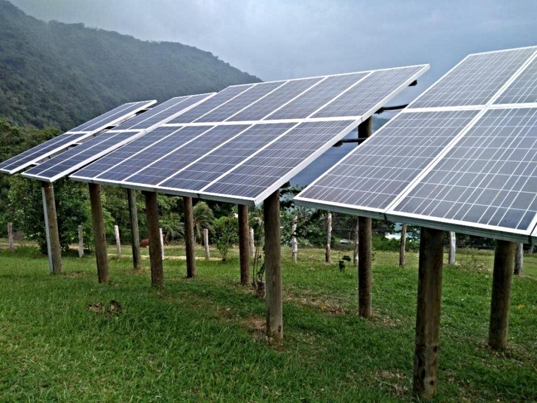
    The Vanuatu Ministry of Climate Change and Natural Disaster and the United Nations Development Programme (UNDP) have signed a US$2.6 million project document paving the way for a sustainable energy project funded by the Global Environment Facility (GEF). The Barrier Removal for Achieving the National Energy Road Map Targets of Vanuatu (BRANTV) Project is funded by the GEF and implemented by UNDP in partnership with the Vanuatu Department of Energy. BRANTV has the objective of enabling the achievement of energy access, sustainable energy, and green growth targets of Vanuatu (as per the NERM).

    Funding
    Donor
    Organisation: GEF Least Developed Countries Fund (LDCF)
    Total Funding USD:
    $2,639,726.00
    Progress Indicator
    25-50%
    Project Status
    Current
    Project Scope
    National
    Project Type
    Capacity Building
    Community Awareness
    Field Implementation
    Informal Training Courses
    Pilot / Trial / Demonstration Project
    Planning and Governance
    Policy Formulation and Integration
    Policy Support
    Project Map Points